Predictwind & The Stormy Weather of Cape of Good Hope/Cape Aghullas!

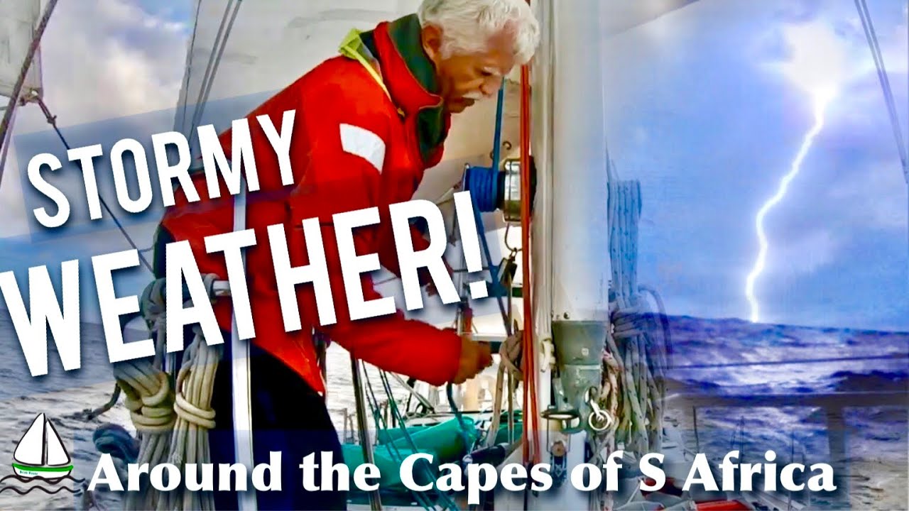
This was Rebecca’s most feared Sail to date…the stormy weather going around Cape of Good Hope and Cape Aghullas! And she was right…we experienced every kind of weather on this passage including a huge electrical storm where we still wonder why we were not struck by lightning! Luckily Predictwind gave us great forecasts through the Idirium GO, right on the Raymarine Chartplotter so we knew what weather was coming before it came! Patrick is t one to use an IPad, but having the wind and currents right on the Raymarine Axiom Pro chartplotter…well he couldn’t avoid looking at the weather forecasts when I downloaded them!
One thing we forgot to mention on the video, is that a Predictwind Offshore DID warn us of a stormy night ahead with its CAPE forecast. There was about a 4 hour period on the Cape forecast on Predictwind that there was a pretty big chance for squalls. Oops…forgot to tell the captain…I was psychologically prepped for bad weather, but he wasn’t. But the smart captain that he is…obviously he saw the dark clouds ahead, turned on the radar, and could see it coming, and got down sails ahead of Time! A perfect example of the bad communication at sea that we have sometimes. It’s not just on land girls…and it’s not always the captain!  The wind and waves were not so bad, but those lightning strikes were pretty darn impressive!
I am glad to have the Cape of Storms behind us, and all beautiful fair weather sailing up ahead…Ha-Ha who am I fooling!
We also forgot to mention we have an “ion dissipator” at the highest point on our mast. Can that be why we did not get struck by lightning? No idea…Probably not.


Using Our Electronics -From Predictwind to our Raymarine Chartplotter to our Monitor Wind Vane to Sail the Wild Coast of South Africa!

A Tour of our Valiant 40. The Bluewater Sailboat. What do we like about it? What would we change?

Preventing a Lightning strike on a sailboat : Lightning Protection

Sailing South Africa with Electronics…Predictwind, AIS, and Raymarine Radar…we used them all!

In the old days, you used barometers, and GRIB files, and listened to SSB and VHF weather reports to round the Cape of Good Hope in South Africa.

Now there is just so much more to aid a sailor.


We used PredictWind Offshore for planning the trip when we had internet, and then during the trip using our Iridium GO! to get updates to know when it was time to seek shelter. This was probably our biggest tool for weather Routing using the ocean current models , as well as four wind and wave forecasts from Predictwind to make sure we got it right.

We would not sail any ocean now without the Iridium GO and the Professional version of Predictwind Offshore. I would simply refuse to leave the dock without it!

Latest Video

Here is the latest video with us sailing from Richards Bay, underway through lots of wind and speedy currents on the way to Cape Town. It’s part one of a 2 part series, as we need to seek refuge from an upcoming storm, in East London for a few days.


Sailing the African Coast – Dodging Storms…Zanzibar and Southward


Sailing the African Coast – Dodging Storms…Zanzibar and Southward

Sailboat Brick House Prepares for a long, stormy passage down the coast of Africa, starting in Zanzibar. This is just the very beginning of the trip, and perhaps a harbinger for things to come? We arrive in Dar Es Salaam planning to spend several weeks, maybe even a month, enjoying ourselves in Tanzania, and getting the boat ready; provisioning, and fueling up for the long 1700 mile trip ahead of us to South Africa. Then we get some weather information and everything changes quickly!

Weather Program on SV Brick House

Hello Africa! Sailing through a Southern Buster from Mayotte to Tanzania

Mozambique In April, May and June


Zanzibar Marina, Tanzania, East Africa – A month at the new marina!